


![]()
Esri is the pioneer and global leader in Geographic Information System (GIS) technology. The Redlands, California-based company architected the assembly and analysis of geographic information – the science behind modern-day GIS – to inform landmark projects and develop leading-edge products.

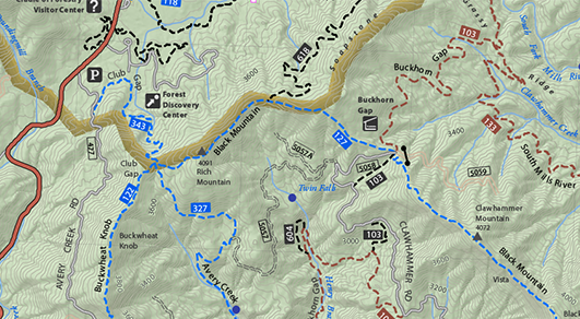
ArcGIS® for Desktop is the primary authoring tool for the ArcGIS platform.
Beyond showing your data as points on a map, ArcGIS for Desktop gives you the power to manage and integrate your data, perform advanced analysis, model and automate operational processes, and display your results on professional-quality maps. In addition, you can share your maps and GIS resources with ArcGISSM Online and ArcGIS for Server. You can also easily package maps and layers and make that content available via ArcGIS Online.

ArcGIS Enterprise is a key component of the ArcGIS platform.
It provides you with a complete GIS that runs behind your firewall, in your infrastructure, on-premises, and in the cloud and works with your enterprise systems and policies.


ArcGIS Online is a complete, cloud-based mapping platform.
Make and share beautiful maps, and do everything in between. It’s possible only with ArcGIS Online, a scalable and secure software-as-a-service hosted by Esri.

Esri’s next-gen 64-bit desktop GIS product is ArcGIS Pro.
Technologically ahead of everything else on the market, ArcGIS Pro provides professional 2D and 3D mapping in an intuitive user interface. You can think of ArcGIS Pro as a big step forward—one that advances visualization, analytics, image processing, data management, and integration.

ArcGIS apps get the job done through their sheer focus, geographic awareness, and readiness to work. They are powered by the industry-leading ArcGIS mapping platform.

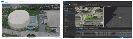
ArcGIS includes powerful mapping applications, ArcMap and ArcGIS Pro, that provide a common source of truth for planning field workforce operations. Think of it as a 360⁰ view between the field and back office.
Field data collection deserves a solution as specialized as the data it provides. Put everything on the map—asset information, survey results, and imagery
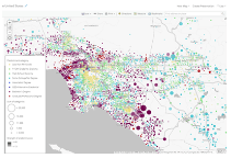
DashboardStay on top of your field operations by monitoring, tracking, and reporting real-time data feeds to focus on what matters most. Monitor field work status using Operations Dashboard for ArcGIS.
🔗 Esri Brochure

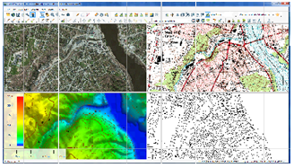
GIS — only easier, more affordable, and more accurate. Since the early 1990s, Blue Marble Geographics has been a pioneer in the development of powerful and affordable GIS, geomatics, and LiDAR processing software.

Global Mapper is a robust GIS application that combines a comprehensive array of spatial data processing tools with access to an unparalleled variety of data formats at a genuinely affordable price. Developed for both GIS professionals and map enthusiasts, Global Mapper has virtually everything you need in a GIS.

![]()

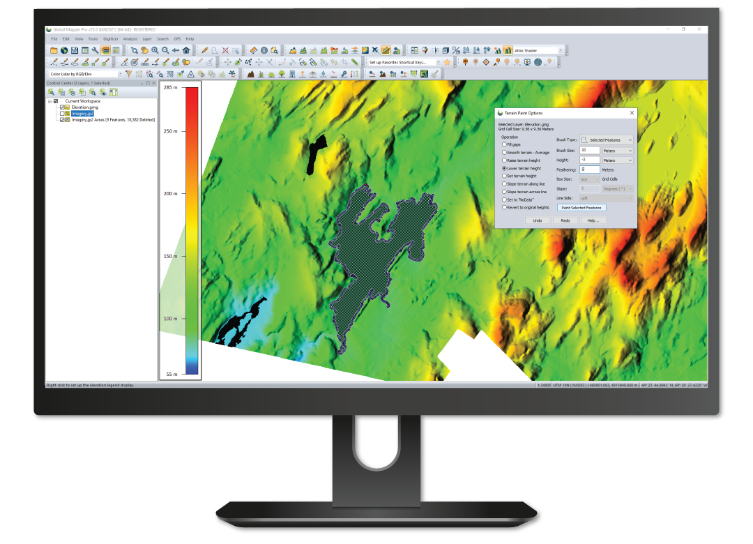
Global Mapper Pro® supplements all of the features and functions in the base version of Global Mapper® v23 with a varied collection of professional-grade geospatial tools. Incorporating all of the point cloud processing functionality previously available in the Global Mapper Lidar Module, the Pro version provides power users with numerous new and enhanced data processing and analysis tools, which complement and expand the Lidar Module’s functionality.

Geographic Calculator is the standard-bearer in the field of geomatic calculation and transformation. Built on the largest database of geodetic definitions and coordinate system parameters commercially available, this powerful software is designed to ensure accuracy and consistency in any geospatial data management process.
Geographic Calculator’s extensive data source includes :
More than 5,000 pre-defined projected coordinate systems
More than 1,800 coordinate transformations
More than 500 horizontal datums
More than 150 vertical datums
(necessary for LiDAR transformations)
More than 80 various unit definitions
Full matches to ESRI, MapInfo, Autodesk
Custom coordinate systems
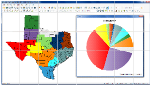
Choosing a datum transformation in Geographic Calculator
A land survey summary in Geographic Calculator
Geographic Calculator’s data source includes - Brochure

We’re focused on creating powerful mapping software that facilitates design, publication, and spatial imaging. Organizations and individuals use MAPublisher and Geographic Imager to create maps to help solve real-world issues Users consume high-quality cartographic products created and sold by publishers through the Avenza Mapsapp and Map Store
Create Maps With Geospatial Data in Adobe Illustrator
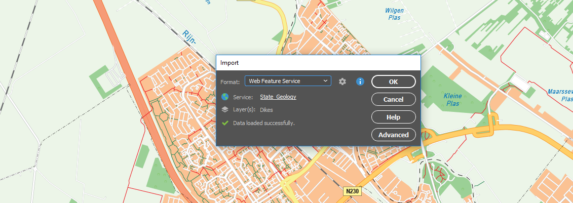
MAPublisher® cartography software seamlessly integrates more than fifty GIS mapping tools into Adobe Illustrator to help you create beautiful maps. Import industry-standard GIS data formats and make crisp, clean maps with all attributes and georeferencing intact using the Adobe Illustrator design environment.
Seamless integration with Adobe Illustrator
Import and map geospatial data
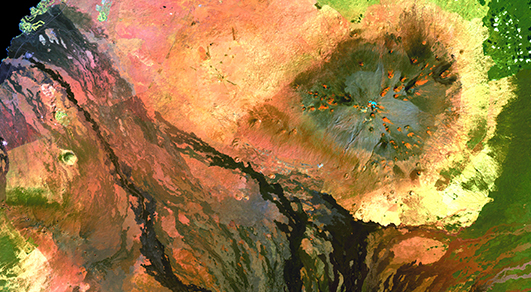
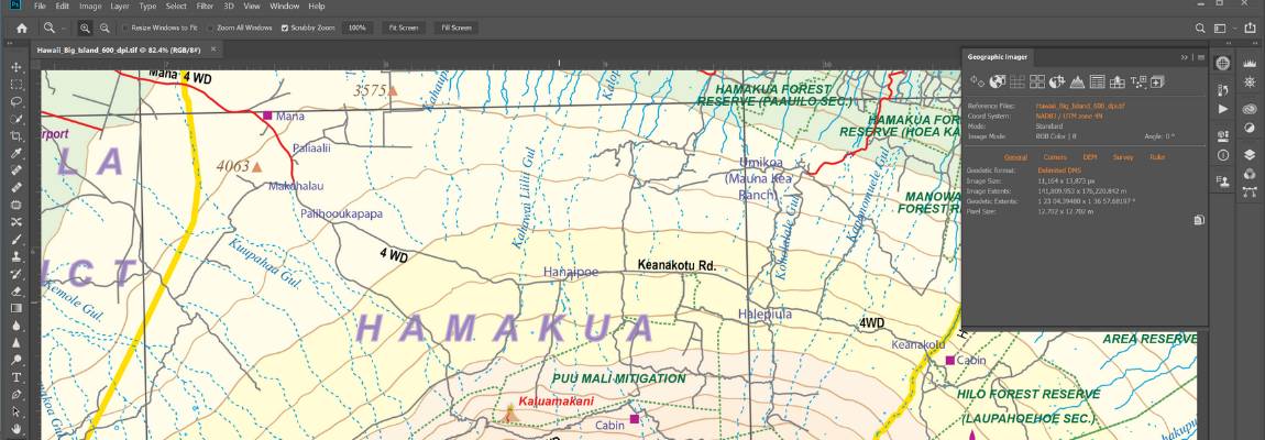
Working With Geospatial Imagery Doesn’t Have to be Complicated
Geographic Imager® mapping software enhances Adobe Photoshop to make working with spatial imagery quick and efficient. It adds tools to import, edit, manipulate and export geospatial images such as aerial and satellite imagery. Enjoy the use of native Adobe Photoshop functions such as transparencies, filters, pixel editing, and image adjustments like brightness, contrast, and curve controls while maintaining spatial referencing.
Seamless integration with Adobe Photoshop
Retain geospatial properties
Almost a million maps for your mobile device
Use Avenza Maps® on your mobile devices to locate yourself without the Internet or network connections. Take Avenza Maps hiking, biking, climbing, camping and anywhere you need a map outdoors. Use your device’s built-in GPS to stay safe, on track, on the trail, and aware of where you are on any map, even in the most remote places.
The world’s largest digital map store
Roam without roaming
🔗 Avenza Brochure
![]()
Data East is a Russian company based in Novosibirsk providing competent GIS software development, engineering, and consulting services for the full range of Esri professional GIS products on multiple platforms.
Data East offers several GIS software products for solving tasks that range from enterprise data processing and ArcGIS enhancements to creating portable map applications.
Data East’s products, information systems and solutions are used in a variety of industries, including geology and geophysics, oil and gas production, mining engineering, territory and local authorities’ management, natural resource management, land cadastre, farming and agrochemistry, forestry management and more.
Data East is the competency center in geoinformation technologies, the authorized business partner of Esri, Inc. providing competent software distribution, consulting, and training services.

XTools Pro is one of the most popular and full-featured third party extensions for ArcGIS Desktop end users providing a comprehensive set of tools for vector spatial analysis, shape conversion and table management.
Xtools AGP 17.0 is compatible with the new ArcGIS Pro 2.0 and brings two more tools to ArcGIS Pro users – Concave Hull and Divide Overlapping Areas.

CarryMap is a solution for creating mobile offline maps from ArcGIS map documents. Working with the output maps does not require internet connection, which can be valuable for a wide range of users – salespersons, field workers, recreation park visitors, etc. Reproduce your ArcGIS map document as a searchable exe-file or a map file for unlimited distribution available for wide range of non GIS users. Output mobile maps can be used on Windows desktop computers, Android, and Apple iOS devices.
![]()
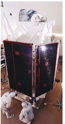
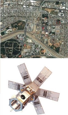
QuickBird satellite offers sub-meter resolution imagery, high geolocational accurancy, and large on-board storage. With global collction on panchromatic and multispectral imagery, QuickBried is designed to support a wide range of geospatial applications.

Resolution 65 cm
Swat Widht 18.00 km
Average Revisit 2.7 days
spectral bands pan +4Ms
Accuracy 23 m CE90
WorldView-1 launched September 2007, is the first of four next-generation satellites the most agile satellites ever flown commercially.
Resoluttion 50 cm
Swat Widht 17.7 km
Average Revisit 1.7 days
spectral bands pan
Accuracy < 4.0 m CE90
WorldView-2, launched October 2009, is the first higt-resolution 8-band multispectral commercial satellite.
Resolution 46 cm
Swat Widht 16.4 km
Spectral bands pan+8Ms
Accuracy < 3.5 m CE90
WorlView-3, the first multi-payload, super-spectral, high-resolution commercial satellite Launching in 2014, the WorlView-3 system will allow DigitalGlobe to further expand its imagersy product offerings.

Resolution 31 cm
swat Widht 13.1 kmAverage Revisit
<1days
spectral bands pan
+8 Ms + 8 SWIR
+ 8 Cavis
Accurancy <3.5 m CE
WorldView-4’s first Public Image, taken on November 26, features the Yoyogi National Gymnasium in Shibuya, Tokyo. The site hosted events during the 1964 Olympic Gmes and will again host international competition when the gemes return to Tokyo in 2020.
Resolution 30 cm
Swat Widht 617 km
🔗 Quickbird Brochure
The Pleiades constellation provides colour products at 50 centimetres that deliver an extremely high level of detail. These products’ location accuracy and excellent image quality make them the ideal solution for precision mapping.

SPOT 6/7 Satellite Imagery
TerraSAR-X Radar Satelite Imagery
TerraSAR-X and TanDE-X dependably acquire hight-resolution and wide-area radar images independent of the weather conditions. The two satelites feature a unique geometric accuracy that is unmatched by any other spaceborne sensor. With the upcoming addition of PAZ, the three almost identical satellites will be operated in a constellation and will deliver optimized revisit time, increased converage and improved service.
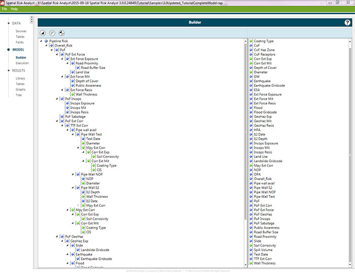
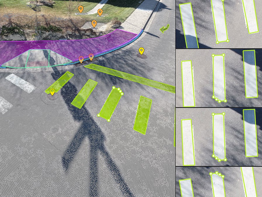
Quickly and Obkectively Measure Risk Along the Pipeline with Spatial Analys.
Perform dynamic segmentation to determine risk on unique segments of the pipeline
Analsy performs geospatial linier asset risk analysis
This results in highly accurate risk results that promote defensible decision making throughout the organization
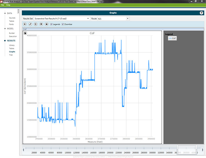
Spill Impact Analyst Evaluates Pipeline Risk and Allows You to Create Accurate mitigation Plans.
Provides user-Friendly controls to calculate release points at distance intervals, specified locations, and National Hydrology Datasets (NHD) waterway intersection.
Calculates release volume based on valve isolation points, line fill, depth of cover, valve closure time, response time, and flow rates to help you.
Displays detailed analysis results as polygon spill plumes in ArcMap.
Provides reporting and graphs including time-to-impact, impact volume, volume released from a pipeline during Full Flow (prior to shut down and isolation), Drain down (after shutdown and isolation), and Total (combination of full flow and drain down) Which is particularly useful inemergency flow restriction Device (EFRD) analysis.
![]()
Pix4D is a market leader in photogrammetry software technology. Our products enable you to digitize reality and measure from images taken from planes, drones, phones, or any other camera. We revolutionize photogrammetry, so you can scale up and unleash the power of your imagery.
PIX4Dmapper

A unique environment connecting your original images to each point of the 3D reconstruction to visually verify and improve the accuracy of your project.
PIX4Dcloud

PIX4Dsurvey
![]()
The industry standard softwarefor point cloud and image processing . Terrasolid is the industry standard software for point clouds and images processing, developed specifically for the demanding requirements of geospatial, engineering, operations and environmental professionals.
Our software suite provides versatile and capable tools to create 3D vector models, feature extractions, orthophotos, terrain representations, advanced point cloud visualizations, etc., no matter the data source, no matter the sensor. The finest tools for calibration and matching of point clouds for LiDAR data are included.
TerraScan
TerraScan is the main application in the Terrasolid Software family for managing and processing all types of point clouds. It offers import and project structuring tools for handling the massive number of points of a laser scanning campaign as well as the corresponding trajectory information. Various classification routines enable the automatic filtering of the point cloud.

TerraModeler
With TerraModeler you can create, edit, and utilize surface models. TerraModeler creates surface models (TINs) from various sources, such as LiDAR points stored in binary files or loaded in TerraScan, XYZ ascii files and graphical design elements. The software offers versatile visualization options including colored shaded surfaces, contour lines, grids, colored triangle nets, elevation texts, slope directions and textured surfaces (in combination with TerraPhoto).
![]()

TerraPhoto
TerraPhoto is specifically developed for processing images captured together with laser data during a survey mission. The software enables the production of rectified images and ortho mosaics based on ground model that has been extracted from the laser data. The positioning of the source images can be refined by using tie points for image-to-image adjustment while ground control point can be involved for improving the absolute accuracy of the image block.
![]()
What is Creative Cloud?
Creative Cloud is a collection of 20+ apps for photography, video, design, web, UX, and social media – plus color palettes, font families, collaborative tools, and so much more. Join our global creative community and make something better together.


Work flows with Acrobat.
Adobe Acrobat keeps you connected to your team with simple workflows across desktop, mobile, and web — no matter where you’re working.
E-signatures keep work moving.
Adobe Acrobat Pro DC with e-sign combines the power of Adobe e-signatures with our industry-leading PDF tools. Try it now with a free, 7-day trial.
🔗 Acrobat DC product comparison - Brochure
🔗 Adobe Creative Cloud for teams - Brochure

Bring out the best in your work and everyday life. Microsoft 365 is a suite of apps that help you stay connected and get work done

Microsoft Word
Create stunning documents and enhance your writing with built-in smart features.
Microsoft Excel
Simplify complex data and create easy-to-read spreadsheets.
Microsoft PowerPoint
PowerPoint Create stunning presentations with ease.

Microsoft Teams
Bring everyone together in one place to meet, chat, make calls, and collaborate.
Microsoft Outlook
Manage email, calendar, tasks, and contacts in one place.
OneDriver
Save, access, edit and share files and photos wherever you are.
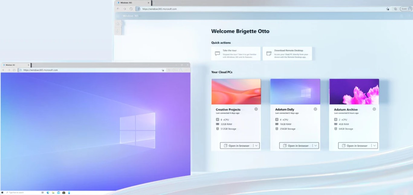
Windows 365 combines the power and security of the cloud with the flexibility and simplicity of a PC. From contractors and interns to software developers and industrial designers, Windows 365 enables new scenarios for the modern working age.
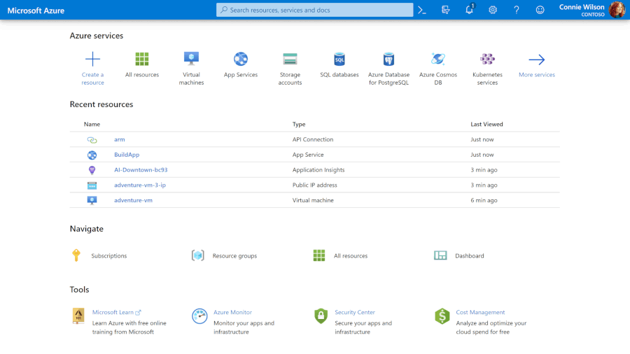
Azure Purview is a unified data governance solution that helps you manage and govern your on-premises, multicloud, and software-as-a-service (SaaS) data. Easily create a holistic, up-to-date map of your data landscape with automated data discovery, sensitive data classification, and end-to-end data lineage. Enable data consumers to find valuable, trustworthy data.
![]()
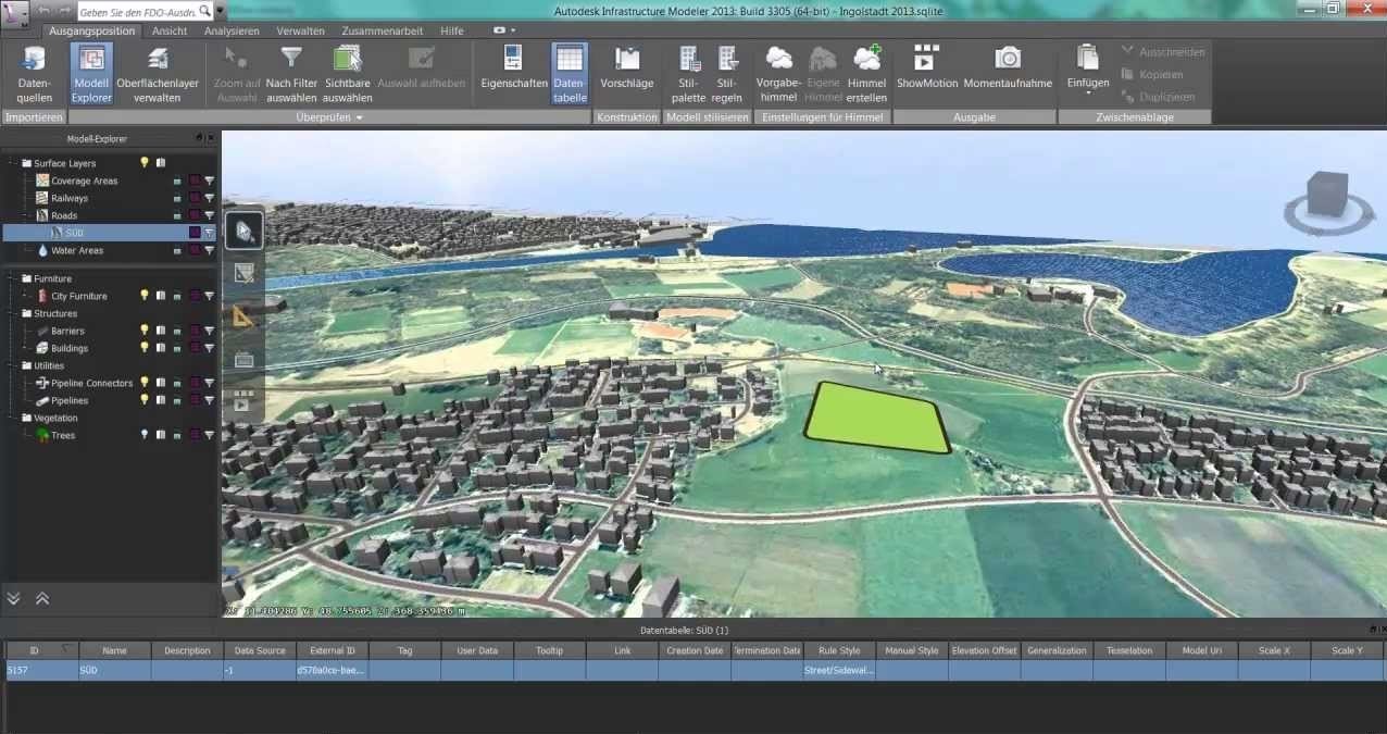
Autodesk Infrastructure Design Suite Ultimate 2016 builds on the the value of the Premium Edition with specialized capabilities for roadway design, architectural design, MEP engineering, and structural engineering
Autotdesk Infrastructure Design Suite Premium 2016 enhances your ability to implement BIM for infrastructure, by providing model-based civil, structural and utility design, analysis, and visualization capabilities.
Aoutodesk Infrastructure Design Suite Standard 2016 offers a familiar AutoCAD workflow with foundational planning, design, and coordination capabilities.
Autodesk infrastructure Design Suite is a comprehensive Building Information Modeling (IBM), solution for planning, designing, building, and managing infrastructure projects. Get the flexibility to innovate now in a single economical and convenient purchase.
Autodesk Building Design suite is a comprehensive software solution, combining the tools you need for both CAD and Building Information Modeling (IBM) workflows in one flexible, cost-effective package.
Autodesk IDS Premium
Autodesk IDS Standard
Autodesk IDS Ultimate
Autodesk BSD Standard
Autodesk BSD Premium
Autodesk BSD Ultimate
🔗 AutoCAD 2022 - Brochure🔗 Autocad civil3d - Brochure🔗 Autocad 2021-Brochure🔗 Autocad lt 2021-Brochure