Meet regulatory requirements for data integration and risk analysis with the powerful Spatial Risk Analyst. This robust desktop application allows pipeline operators to quickly and objectively measure risk along the pipeline through a variety of customized risk algorithms (models)…more
Application development is the process of creating a computer program or a set of programs to perform the different tasks that a business requires. ... Every app-building process follows the same steps: gathering requirements, designing
Professional Services for ArcGIS
Our highly trained and experienced staff are experts in deploying and managing all aspects of the ArcGIS Platform and Esri Geospatial Cloud for location-based visualisation, systems integration and analysis
Spill Impact Analyst provides invaluable assistance when developing highly accurate leak mitigation and response plans. With this accurate modeling, operators can create plans to effectively respond to leaks and remedy a situation in less time.verall lower cost…more
Spill Impact Analyst provides invaluable assistance when developing highly accurate leak mitigation and response plans. With this accurate modeling, operators can create plans to effectively respond to leaks and remedy a situation in less time.verall lower cost…more
Gas HCA Analyst is a software application that determines how many structures fall within proximity of a pipeline (Class Location) and identifies high consequence areas (HCA) and regulated onshore gathering lines…..more
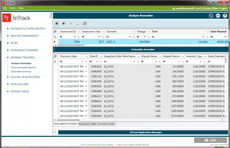
InTrack is a planning and analysis application that integrates inspection data with your pipeline GIS and asset information. InTrack allows integrity and GIS teams to identify actionable anomalies that require remediation as well as plan for and schedule upcoming assessments… more